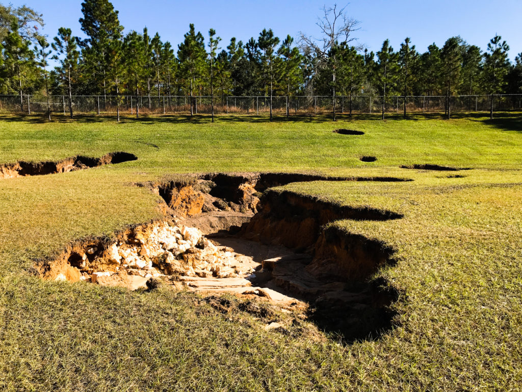
Karst topography refers to land that is prone to sinkholes which are empty pockets that form underground due to the presence of certain types of geology (such as limestone). This type of geology is susceptible to excessive water causing the rock to dissolve over time until a sinkhole forms.
You have probably already read or heard stories about sinkholes caving in and causing damage to roads and properties. It is very likely these events occurred in areas of karst topography.
How It Affects Land Development Design
Karst topography is something that should be taken into account during the land development design process in order to help prevent the formation of sinkholes.
In particular, a stormwater management design in a known karst area could potentially lead to sinkhole issues. The reason is because one the main features of a stormwater management system is that it collects stormwater from a relatively large area and concentrates it into a smaller area. Any extra water that is allowed to infiltrate back into the ground that was not infiltrating into that area before could lead to a sinkhole.
How to Determine If Your Property Contains Karst Topography
It could be that there are some areas within or near your property that may be known karst areas or that are more prone to developing sinkholes than other areas. If you have already hired a civil engineer to design a land development for your property, this person might have enough experience working in your area to let you know right away if your land is in or near a karst area.
You could also hire a professional geologist to determine if your land contains karst topography or could be prone to forming sinkholes.
Another method of determining the potential for sinkholes is doing some research using a local online GIS system. You would have to locate your site within the system and see if the underlying geology of an area is something the system contains. The description of the geology could include something stating that it is in a karst area or you might have to do some research to see if the rock that is labeled is related to karst topography.
Measures Taken in Areas of Karst Topography
Once the design engineer or a land development engineer knows that an area is in a karst area, measures would probably have to be taken to help prevent sinkholes or repair sinkholes that do form during construction.
One measure that could be taken during the design of a new land development is ensuring a wider than usual stormwater management system. This would minimize the amount of stormwater that would be concentrated into a small area. Another measure could be including an impermeable liner at the bottom of a stormwater management system to prevent stormwater from infiltrating into the ground.
The land development plans might also include details for how to repair any sinkholes that form during the construction of the plans.
The Importance of Knowing If Your Site Is in an Area of Karst Topography
It is important to know if your property is in a karst area at the start of the land development design. This helps to avoid the costs of a redesign of your plans later and the costs of sinkhole remediation that could have been prevented.
Related: How to Create a Land Development Design (In 12 Steps)
Related: Recommendations for Sinkhole Books


