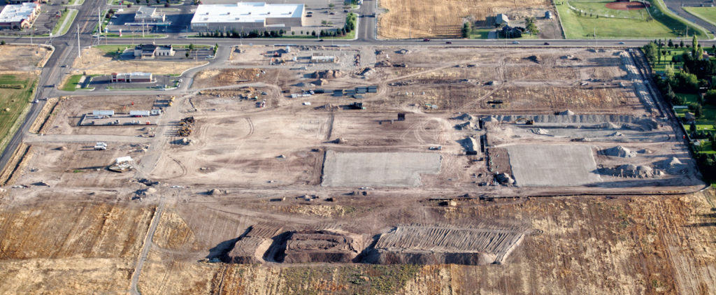
To get to a point of being able to be constructed, a land development project has to be designed by a civil engineering company that goes through a complex series of steps to create a land development plan that can be approved for construction.
The following are twelve steps involved with a typical land development design.
1) Research local, state, and federal regulations.
2) Create a base survey plan.
3) Add the proposed layout to the land development plan.
4) Prepare a rough layout of the stormwater management design.
5) Prepare the grading design.
6) Finalize the stormwater management design.
7) Create the stormwater conveyance design.
8) Create design profiles.
9) Prepare the erosion and sediment control design.
10) Prepare the landscape and lighting plan.
11) Submit the land development plan for review and approval.
12) Obtain any other required permits and approvals.
1. Research Local, State, and Federal Regulations
One of the first steps of any land development should be to research and become familiar with what regulations a new land development project would have to comply with at the local, state, and federal level of government.
The main regulations would be at the local level through the zoning and land development ordinances of the municipality where the project site is located.
At the state level, permits may have to be obtained from the state department of transportation or the state environmental agency for projects that would impact roads or waterways that are regulated by the state.
A common issue at the federal level is the obtaining of an approval for a project to impact a floodplain that is regulated by FEMA (Federal Emergency Management Agency).
Related: Land Development Regulations (A Simple Guide)
2. Create a Base Survey Plan
Before any actual design work can start with a land development project, a base survey plan has to be created by a land surveyor. An accurate base plan is required to properly design a proposed layout. This is especially important for a small site or a site where any of the edges of the proposed layout are close to a property boundary where almost every foot of available space would be required for the project to be constructed properly.
The base survey plan would include the property boundaries, existing contours, and other existing features on the site.
Related:11 Common Parts of a Topographic Map
3. Add the Proposed Layout to the Land Development Plan
After the base plan is prepared, the layout of any proposed buildings, parking areas, driveways, and utilities can be accurately drawn on the plan to start the actual design of the land development plan.
This is an important part of the land development design process because it is this layout that drives the rest of the design. Any significant change to the proposed layout during a later step in the process could mean major changes to the rest of design (especially the grading and stormwater management design) which means more time and money having to be spent for the project.
Impervious areas would have to be checked during this step for compliance with the current zoning ordinance requirements.
Advertisement
4. Prepare a Rough Layout of the Stormwater Management Design
Stormwater management is a major component of most new land development projects that involves designing a system to collect and manage the stormwater runoff that would be generated from the site during a rainfall event.
After doing some preliminary calculations and delineations of drainage areas, an estimate for a storage volume required for a stormwater management system can be figured out and used to locate where the proposed system should go. For a system that involves a basin above the ground, the basin can be graded during this step of the design.
Related: Stormwater Management (A Guide for the Non-Professional)
5. Prepare the Grading Design
Once the size and location of the stormwater management system is decided and any basins have been graded, the rest of the grading for the site can be designed.
The grading design would require checking the municipality land development ordinance for slope requirements for parking areas, driveways, and general grading.
Related: Site Grading Design (A Guide for the Non-Professional)
6. Finalize the Stormwater Management Design
Even though the majority of the stormwater management design should already be done by this point, it should be checked at this step to be sure that that the design still makes sense with regards to the original delineated drainage areas.
With the grading now in place, the drainage areas can be checked to be sure they are accurate and revised accordingly.
7. Create the Stormwater Conveyance Design
The stormwater collection system would then have to be designed so that stormwater runoff will have a way to get into the stormwater management system through a series of inlets and pipes.
There would most likely be certain requirements to be met as stated in the municipality land development ordinance. There might even be an ordinance designed specifically just for stormwater management and conveyance designs.
Related: Storm Drainage System Design (A Guide for the Non-Professional)
8. Create Design Profiles
There are many times a municipality will require profiles to be drawn for proposed roads, driveways, and the stormwater collection system which would make it easier for these parts of the plan to be constructed.
Design profiles also allow for the checking of areas where utility pipes and stormwater collection pipes cross in order to show the proper proposed separation distances between pipes.
9. Prepare the Erosion and Sediment Control Design
One of the last parts of a land development plan to be designed is the erosion and sediment control plan. This plan would show what devices and methods are proposed to be installed or implemented during construction of the project to minimize erosion and to control sediment.
Even though a municipality might have some requirements for this plan, there could also be a separate set of requirements prepared by the state that have to be met.
10. Prepare the Landscape and Lighting Plan
If required by the municipality, a landscaping and lighting plan might have to be prepared as a part of the land development plan.
However, both the landscaping plan and the lighting plan might have to be designed by others and added to the finalized land development plan set.
11. Submit the Land Development Plan for Review and Approval
Once a finalized set of plans has been prepared, it would then have to be submitted to the municipality for review and approval. The review process might also involve the review and approval of a specific governing group such as a board of supervisors.
Advertisement
12. Obtain Any Other Required Permits and Approvals
A condition of final approval from a municipality might be the obtaining of any other permits and approvals from outside regulatory agencies. These permits and approvals could include highway occupancy permits, stream crossing permits, and approvals from FEMA for impacts to regulated floodplain areas located on the site.
Time Expectations
As shown above, there are a good number of steps involved with getting a new land development project from just a concept to a full set of plans that is approved and ready for construction. This process could easily take many months to a year or longer.
A discussion with the civil engineer that is managing your particular project should be able to provide at least an estimate for how long the project could be expected to take.