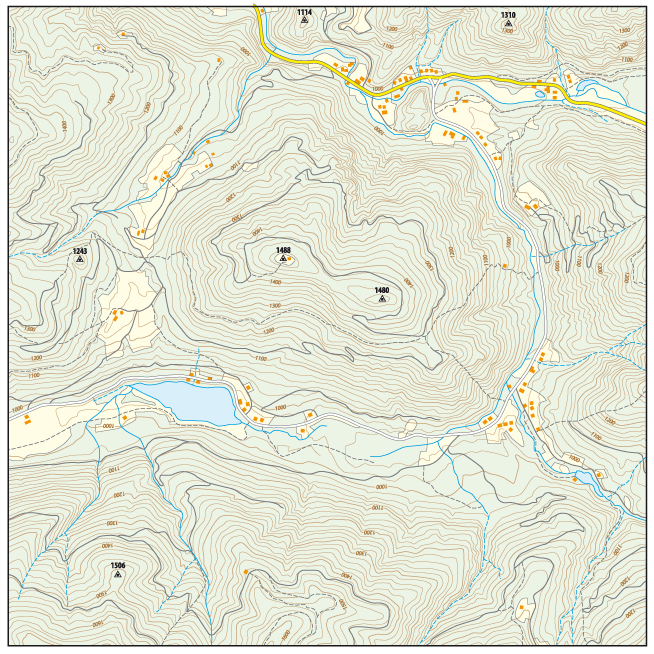
A topographic map can be a valuable tool for analyzing the existing conditions of a site and for designing a new construction project. However, being able to properly read a topographic map means knowing the following 11 common elements of a topographic map.
1) North Arrow
2) Legend
3) Graphic Scale
4) Text Scale
5) Title Block
6) Location Map
7) Buildings and Other Structures
8) Bodies of Water
9) Roads and Other Impervious Areas
10) Contours
11) Woods and Individual Trees
1. North Arrow
The north arrow is a basic but very important element of a topographic map. Through indicating the orientation of your map relative to the direction of north, the north arrow allows you to be able to see how your area of interest relates to other locations that are not located on the map.
2. Legend
The map legend is the block of information usually located along one of the sides of the map. This block contains a list of the various map symbols, line types, and hatching patterns used to create the map along with a description of what those symbols and line types represent. Depending on the kind of topographic map you are using, the legend may include information for buildings, roads, contours, wetlands areas, and utility lines.
Advertisement
3. Graphic Scale Bar
Another important part of a map that has been prepared properly is the graphic scale bar which graphically shows the scale of the map. One of the main benefits of the graphic scale bar is that it allows you to determine what engineering scale to use to properly measure distances off of the map.
Related: What Is a Graphic Scale and Why Does It Appear So Often?
4. Text Scale
The text scale is the written confirmation of the scale of the map. It is a good idea to make sure the text scale matches the graphic scale bar before working with a topographic map.
5. Title Block
The title block is the block of information that lists things such as the name of the map, the date the map was created, the company that created the map, and the address of the topographic information that is shown on the map. This would be a good place to go if you want to contact the person or company who created the map with any questions about the map.
6. Location Map
The location map is the small map usually placed at one of the corners of the overall map, and drawn at a much larger scale, that shows the location of the overall map relative to the surrounding areas. If you are dealing with a land development plan, the location map can be used to determine driving directions to get to the project site.
7. Buildings and Other Structures
The main reason for using a topographic map is to analyze the existing conditions of an area of land. A major component of the existing conditions of an area of interest would be any buildings and other structures such as retaining walls and dams.
8. Bodies of Water
The bodies of water that would be shown on a map could include natural creeks, rivers, and ponds. These bodies of water could also include man-made ponds that were designed and built as part of past land development projects. Locating these elements of a map is important to land development engineers who are designing stormwater management systems.
9. Roads and Other Impervious Areas
Another major component of the existing conditions of an area is the location of any roads, driveways, and other associated impervious areas. Other impervious areas would include parking lots and sidewalks. Having this information is important to be able to figure out how much extra impervious area would be allowed for a potential new project.
Advertisement
10. Contours
Existing contours are another important part of the existing conditions of an area of land. They allow you to determine the slope of the land, which way stormwater runoff drains, and how the grading of a proposed land development design will actually tie into the existing ground.
11. Woods and Individual Trees
Existing woods lines as well as the location of existing individual trees can also be an important part of a map since they would allow you to evaluate the impact of a proposed land development on these features so that a new project can properly design a landscaping plan that would address the removal of any trees.
Topographic Maps Provide Useful Information
The above list shows you just how much information a topographic map can provide. Getting the most out of this kind of map requires being familiar with the many elements that are involved in the overall presentation of the map.
Related: What Is a Topographic Map and How Is It Useful?
Related: How to Read a Topographic Map
Related: Recommendations for Topographic Maps


